Header


Phoebettmh Travel

Travel to anywhere, Travel Point, Travel tour list, Start Nowwww...

(Turkey) – Cappadocia - Land of fairy chimneys

Cappadocia; also Capadocia; Turkish Kapadokya, from Greek: Καππαδοκία / Kappadokía, Armenian: Կապադովկիա Kapadovkia, Persian: کاپادوکیه Kāpādōkiyeh) is a historical region in Central Anatolia, largely in Nevşehir Province.

(Turkey) - Cappadocia - Land of fairy chimneys


Cappadocia, a dreamy slice of central Turkey dotted with ‘fairy chimneys’ (rock formations), has a history every bit as remarkable as its landscape. Volcanic eruptions created this surreal moonscape: the lava flows formed tuff rock, which wind and rain sculpted into sinuous valleys with curvy cliff faces and pointy fairy chimneys. Cappadocians chiselled homes in the soft rock, paving the way for cave-dwelling hippies and today’s boutique fairy-chimney hotels.

(Turkey) - Cappadocia - Land of fairy chimneys

The area’s most extraordinary phase was during the medieval era, when the valleys were a refuge for Byzantine Christians. The religious troglodytes established monastic settlements, and their cave churches add a biblical solemnity to the Flintstones-like region. The Göreme Open-Air Museum, a World Heritage site, has the best collection of chapels and living quarters, most dating to around the 11th century.

(Turkey) - Cappadocia - Göreme Open Air Museum


Here are some must-see and must-dos while you’re in the area:

Byzantine frescoes

Despite centuries of weathering and vandalism, many of the frescoes (or more accurately seccos, painted on dry rather than wet plaster) are glorious, colourful sights. The Dark Church has the best examples: multicoloured angels cover the pillars and vaulted ceilings, along with scenes such as the birth of Jesus, with an ox and ass poking their noses into the manger. As the church’s name suggests, the lack of light has preserved the representations, which still look fresh and vivid after a millennium.

(Turkey) - Cappadocia - Land of fairy chimneys

Other monastic complexes nestle in the valleys, many recalling Star Wars backdrops (but don’t believe mischievous guides who claim Chewbacca was ever here). The most popular for a stroll is Ihlara Valley – filled with riverside greenery, birdsong and a string of churches cut into the base of towering cliffs.

(Turkey) - Cappadocia - Ihlara Valley

Explore underground cities

The local Christians were persecuted, first by the Romans and then raiding Muslims, and they often had to hide from hostile forces. When they heard hoof beats, they would abandon the cave churches and go underground – quite literally. Beneath Cappadocia’s rock formations is a network of subterranean cities, which housed up to 10,000 people each. The largest discovered are almost ten levels deep, with narrow passages connecting the floors like hamster tunnels.

(Turkey) - Cappadocia - Ihlara Valley

Touring the cities, you pass stables with handles used to tether the animals, churches with altars and baptism pools, walls with air circulation holes, granaries with grindstones and blackened kitchens with ovens. The ventilation shafts were disguised as wells, and chunky rolling-stone doors served as last lines of defence.  Not many artefacts remain – the inhabitants took their possessions when they returned to the surface – but the cities give a sense of life continuing in tough conditions.

(Turkey) - Cappadocia - Land of fairy chimneys

Live like a troglodyte

Staying in Cappadocia today doesn’t involve any hardship or subterranean chambers. Many cave dwellings and fairy-chimney chapels have been converted into boutique hotels, where you can try the troglodyte lifestyle in luxury. Features include cave hamams (Turkish baths), rock-cut arches, walls patterned with volcanic colour-banding and panoramic terraces surveying the valleys. You’ll quickly discover what the locals have known for centuries: the tuff rock keeps rooms cool in summer and warm in winter.

(Turkey) - Cappadocia - Land of fairy chimneys

The allure of tourist dollars has tempted many Cappadocians away from agriculture. The pigeon houses riddling the rock faces – traditionally used to collect the birds’ droppings for use as fertiliser – mostly stand empty. Nonetheless, village life continues and vestiges of the fabulous past remain – including the local wine. Cappadocia has one of the world’s oldest wine industries, which stretches back some 4000 years to the Hittites – the first to recognise the volcanic soil’s viticultural qualities, and to carve rock cellars. As you sample the Anatolian grape, there’s certainly a great deal of history to reflect on in this land of fairy chimneys and Byzantine remains.

(Turkey) - Cappadocia - Land of fairy chimneys

How to

Turkish Airlines flies from Istanbul to Nevşehir, Cappadocia. It also flies to nearby Kayseri from Istanbul, as does Anadolu Jet, while Pegasus Airlines flies from both Istanbul and Izmir and Sun Express flies from Germany. Daily buses from Istanbul take about 11 hours (normally overnight).

(Turkey) - Cappadocia - Land of fairy chimneys

Visit the churches and underground cities early in the morning, at midday or near closing to bypass the tour groups. Particularly at the underground cities, a guide is beneficial as they can explain what happened in the bare stone chambers.
(Wiki &Lonely Planet)
Read more

(Mexico) - Baluarte - New Bridge Crowned World’s Tallest

At 1,321 feet high and 3,687 feet long, Mexico’s recently completed Baluarte Bridge is now the tallest bridge in the world. Spanning a ravine in the Sierra Madre Occidental Mountains (also known as the Devil’s Backbone) in north Mexico, it is high enough to fit the Eiffel Tower underneath it. This week the country celebrated its inauguration ceremony, which coincided with the 200th anniversary of Mexico’s independence from Spain. However the bridge isn’t just a record breaker – it is also helping to remove communities from the isolation while reducing the country’s emissions by connecting the country more efficiently.

(Mexico) - Baluarte - New Bridge Crowned World’s Tallest

The Baluarte Bridge is part of the Mexican government’s pledge to improve its national infrastructure. It will form part of the new Durango-Mazatlán Highway when it is open to the public, and it will reduce journeys between the two cities by almost six hours. Considering the amount of haulage and commercial transport that goes between the two, the bridge is set make a significant difference in traffic emissions as well as journey time. In order to make transport in the region more efficient, the government is also planning eight other bridges that will be higher than 300 meters, as well as over 60 tunnels.

(Mexico) - Baluarte - New Bridge Crowned World’s Tallest
 
By providing a transversal link between the Pacific and the Atlantic, the bridge will also allow greater access to towns and cities in nine Mexican states including Chihuahua, Coahuila, Durango, Jalisco, Nayarit, Nuevo León, Sinaloa, Tamaulipas and Zacatecas. The Baluarte Bridge cost over 2 billion pesos  (approximately $145 million) and it is supported by 152 steel suspenders. With a central span of 520 meters, drivers in the four lanes of traffic will be driving above the clouds – higher than the infamous Millau Viaduct in France.

(Mexico) - Baluarte - New Bridge Crowned World’s Tallest
 
Speaking at the opening ceremony, President Calderon said: ”This project will unite the people of northern Mexico as never before.” He also received an official notification of the bridge’s record-breaking height from Guinness.

(Inhabitat)
Read more

Twelve Car-Free City Zones

1. Fez, Morocco - Age-Old Portal to City Futures

Exotic spices piled high, the clink of the metalworkers' tools, the famous dye vats of the leather tanners' quarter-the only way to experience Fez (Fès) is by walking its storied medina.

Fez, Morocco
Fez, Morocco

The Moroccan city's central market area is perhaps the world's largest urban car-free zone, but cities on every continent are seeking to restore human bustle and leisurely gait as the prime locomotion of their urban centers. In other words, they're banning motor vehicles.

Of course, city denizens typically walk or take mass transit on the daily jaunts that require drives for their compatriots who live in the suburbs or beyond. It's a large part of the reason that per-person energy use and carbon emissions are relatively low in urban places, and why many people now view cities as the best hope for a sustainable future for the planet.

Fez, Morocco
Fez, Morocco
 Enlightened planners around the world have found that closing whole areas to motor traffic has benefits beyond cutting down on pollution. It creates places to saunter, bike, exercise, and just hang out.

Or shop, for those walking through the famed Blue Gate (shown above) of Fez, Morocco's one-time capital and second-largest city. Fez has set itself apart from other older cities of the world because older buildings there have never been destroyed to make way for automobiles.

Fez, Morocco
Fez, Morocco
 
In the old walled city, there are about 10,000 winding streets, a striking contrast to other Mediterranean cities that have  grown beyond their walls. But, as with many cities that ring that sea, many of the secrets of old Fez are hidden. Casual pedestrians will often see dusty, plain walls with creaky doors, behind which are fragrant, colorful gardens, and mosaic-encrusted courtyards, and atriums.

2. Harajuku, Tokyo - Japan - Shoppers’ Pedestrian Paradise

Young people crowd a narrow, shop-lined street in one of Tokyo's remaining "HokoushaTengoku," or "Hoko-ten." The  phrase means "pedestrian paradise."

Harajuku, Tokyo
Harajuku, Tokyo
The most famous of Tokyo's car-free enclaves was the Harajuku, named after the train station adjacent to the shopping promenade. The area's popularity dated back to the period after World War II, when U.S. forces housed soldiers in the area. Japanese youths started to hang out there, to see the exotic American fashions. In latter years, it became the place where  so-called Harajuku Girls could parade-often to the sound of street bands-displaying every imaginable look from period-perfect rockabilly, to hip-hop, to goth.

Harajuku, Tokyo
Harajuku, Tokyo
Japanese authorites, concerned about the crowds, in 1998 ended the car-free Sundays that reigned for 20 years at Harajuku.

Still, several shopping areas in Tokyo, including in the upscale Ginza section, are closed to cars on Sundays.

3. Montreal, Canada - Sheltered Passage

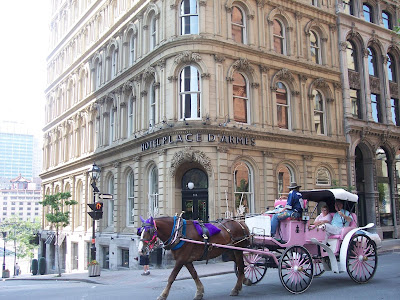
Montrealers have, since the city's birth in the 1600s, dealt with a harsh climate in style. Winter sports and serious winter gear are two ways, the wealth of bars and cafes to warm up in, another. But the building of the modern metro system in the 1960s gave the city's inhabitants an excuse to dig a way out of the chill.
Montreal, Canada
Montreal, Canada
As office buildings and metro stations went up, the so-called Underground City spread through downtown like a spider's web. It's pretty easy to get lost in the warren of shopping zones, entered via metro entrances, office complexes, symphony spaces, and department stores. What could be a sterile mall-like environment is enlivened by art installations, performances, and the occasional boite, where thirsty Montrealers stop for a quick happy hour drink.

Montreal, Canada
Montreal, Canada

4. Freiburg, Germany - A Choice to Use Less

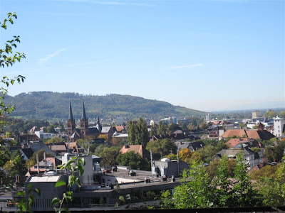
People amble easily around a public transit stop in Freiburg, a city in southwest Germany that was largely destroyed by bombing in World War II.

Tour guides typically remark on the post-war restoration of the medieval architecture, but more impressive still is the rebuilding of the city in more recent decades to curb energy use.

Freiburg, Germany
Freiburg, Germany
The move toward green started in the 1970s, when the Baden-Württemberg region began plans to build a nuclear power plant nearby. Freiburg citizen protests and civil disobedience helped to block the project, and the newly energy-aware populace began focusing on steps aimed at conservation.

Strict energy-efficiency standards for new homes, combined heat and power, and solar systems help reduce demand from the electric grid.
Freiburg, Germany
Freiburg, Germany
And one enclave of 5,000 people, Vauban, is designated as a car-free neighborhood. Households-mainly medium-density apartments-are close to a tram line that connects the neighborhood to Freiburg's city center. More than two-thirds of the households don't even own a car, a rarity in BMW-loving Germany. Vauban residents must certify yearly that they either do not own a car, or that they keep their vehicle in a reserved parking space on the district's periphery. Bikes and walking are the main ways of getting around, and all the typical services are within walking distance. On the streets that permit car traffic, there are such traffic-calming devices as very low speed limits-30 kilometers (18 miles) per hour.

5. Curitiba, Brazil - Melding Park and Fast Buses

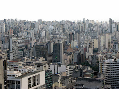
People lounge in one of the public spaces that have earned renown for Curitiba, in southern Brazil, as one of the greenest cities in the world.

Curitiba, Brazil
Curitiba, Brazil
With 16 parks, 14 forested areas and more than 1,000 smaller areas reserved for trees and vegetation, Curitiba is reckoned to have nearly 560 square feet (52 square meters) of green space for every one of its 2 million residents--one of the highest rates in the world for cities. It's especially impressive considering that in 1970, the city was so choked with development and congestion that it had less than 1 square meter of green space per person.
Curitiba, Brazil
Curitiba, Brazil
Jaime Lerner, who served three non-consecutive terms as Curitiba mayor beginning in the early 1970s (and was later governor of the state of Parana), spearheaded a series of innovative programs and reforms that helped transform the city.  Under his stewardship, the city purchased floodplain for parkland.  (The problem of tending all that acreage was sometimes resolved with "municipal sheep" who kept grass in check; the wool was sold to fund children's programs.)

But one of Lerner's most lasting legacies was to de-emphasize the car.  Today, a huge swath of downtown is car-free, except for morning deliveries.  It is all made possible by the bus rapid transit system his administration helped launch.

Curitiba, Brazil
Curitiba, Brazil
With a series of express lanes dedicated to buses only, the system is as fast and reliable as any underground subway--with arrivals as frequent as every 90 seconds in some areas.  Fares are cheap, simple, and subsidized by workplaces. As a result,  even though the relatively wealthy city has one of the highest automobile ownership rates in Brazil, about 70 percent of Curitiba's commuters use public transit. Fuel consumption is below average compared to other urban areas, and the city's air is the cleanest among cities in Brazil.

Lerner has spoken around the world, including in a popular TED talk. on the importance of tapping the potential of  urban planning. "Cities are not the problem," Lerner says. "They are the solution."

6. Melbourne, Australia - A Stroll Down Under

Melbourne's status as a pedestrian-friendly city is due to a happy accident. City planners laid out the Australian city as a grid, but made the spaces from street to street very wide.
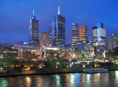
Melbourne, Australia
To make the huge blocks manageable, builders put lanes in between, for deliveries and to break up some of the grid. In recent decades, city officials and commercial owners have realized the possibilities of those narrower lanes; many of them have been turned over either partially or totally to walkers and the smaller business they frequent. Hence, the proliferation of flower shops, book stores, cafes, and restaurants. In addition, a long stretch of a main downtown artery, Bourke Street, was pedestrianized-the only regular vehicular traffic is one of the city's famed tram lines.

Melbourne, Australia
7. Zurich, Switzerland - Dividends for Those on Foot

Quick! What does the word "Zürich" bring to mind?

Zurich, Switzerland
Zurich, Switzerland
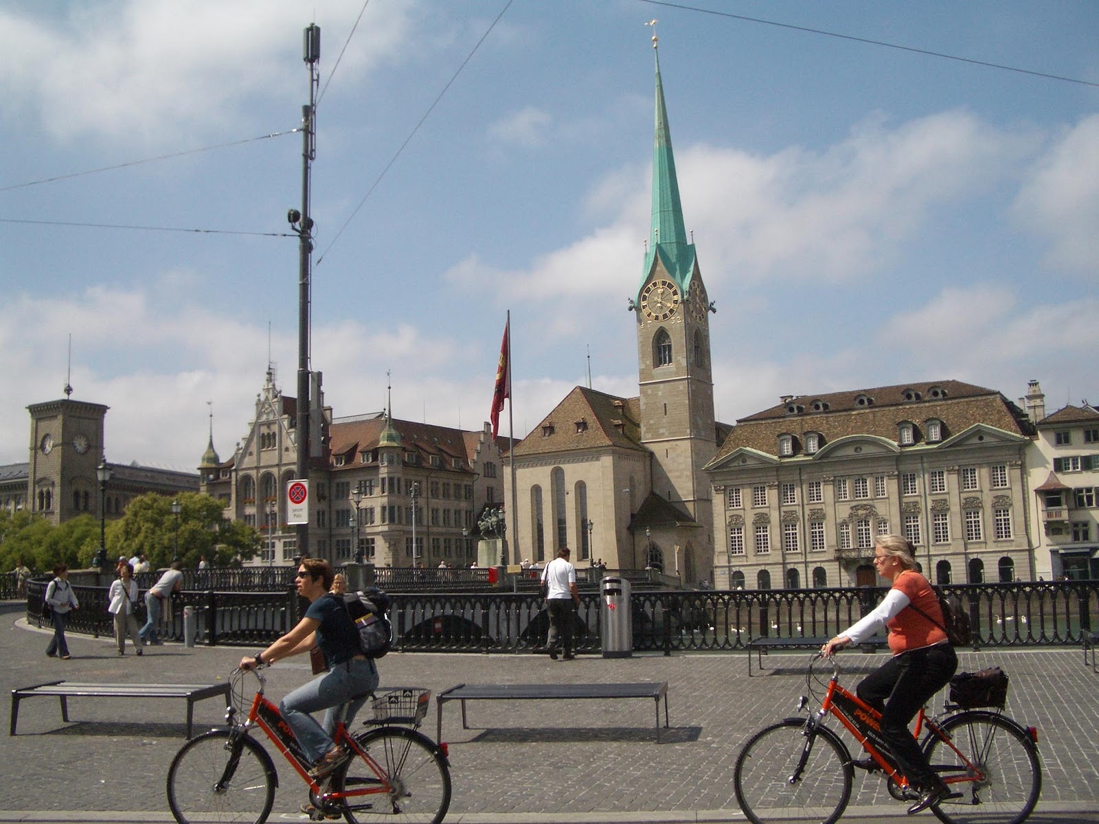
Banks, right? Maybe buttoned-up bankers, too. But in fact, a laid-back vibe governs Zürich's central core, with its beer halls, restaurants, and designer shops. Cars are banned or severely limited from such streets as the Bahnhofstrasse, the avenue that goes from the central rail station to the lake.
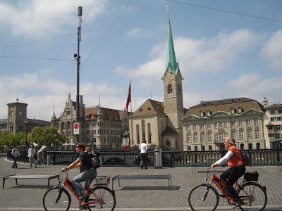
Zurich, Switzerland
Zurich, Switzerland
Without cars, Zürich's residents are free to saunter, shop (yes, and buy expensive Swiss watches almost everywhere), stop at cafes, and in general, enjoy a city that's built to human scale.

8. BarriGotíc, Barcelona - Mediterranean Amble

BarriGotíc, or the old quarter, in Barcelona, seen here at night, is a mostly car-free zone, where visitors can get lost wandering the narrow old streets and alleys, only to encounter wide plazas with gracious old churches, restaurants, and cafes.
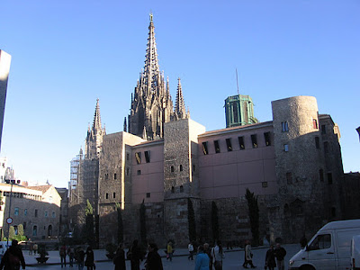
Barri Gotíc, Barcelona
At one end is Las Ramblas, a wide avenue that does allow slow-moving motor traffic along narrow side lanes. But the center is a wide, tree-lined pedestrian mall that offers a little of everything-from the requisite South American flute players, to pet stands selling exotic birds, to hustlers and jugglers, to  souvenirs. It's one of the proud Catalan city's longest streets, starting out tacky near the harbor and growing more respectable, the eateries more avant-garde,  up toward the newer part of the city.

Barri Gotíc, Barcelona

9. Buenos Aires, Argentina - Fair Winds on Calle Florida

The "good air" that inspired the name of the Argentinian capital is perhaps much diminished since its founding in the early 1500s, but the city long has sought to maintain a respite from car fumes.

Even at the dawn of the automobile age, as far back as 1913-the year that marked the opening of Buenos Aires' subway, the first in South America-the city decreed that portions of Calle Florida would be for pedestrians only.

Buenos Aires, Argentina

A 20-block stretch has been fully car free since 1971. Its proximity to the financial center and other attractions means that the street, shown here, has a steady supply of visitors, who come to eat out, see street performers, and shop. The street, a major tourist destination now, wasn't universally popular. Renowned Argentine writer Jorge Luís Borges was one of Calle Florida's most famous residents before his death in 1986. But the blind poet and essayist hated navigating the new planters and other street furniture installed by the municipal government.

Buenos Aires, Argentina

10. Bogotá, Columbia - Buses, Bicycles, and People

Bogotá, a city of 7 million that had no public transit system as recently as a dozen years ago, was at risk of being choked by traffic before enlightened city leaders took matters into hand.

Much credit goes to Enrique Peñalosa, who declared "war on cars" during his three-year term as mayor of the Colombian capital beginning in 1998. He instituted traffic restrictions that cut rush-hour traffic 40 percent. He persuaded the city council to increase the gasoline tax, dedicating half the revenue to the new TransMilenio bus system (its red vehicles are shown crossing the plaza above), which now serves 500,000 commuters daily. It is viewed as a model of how a city can establish new mass transit service by leveraging investment  already made in roads.
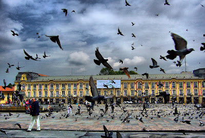
Bogotá, Columbia
Bogotá, Columbia
Peñalosa spearheaded building of bike paths, now used by an estimated  350,000 cycling commuters daily. The changes built on a tradition that began in the 1980s in Bogotá: "Ciclovía," which literally means "bikeway."

On Sundays and holidays, cars are banned from the city's main roadways and bike riders are royalty. So are skateboarders, joggers, and people just out for a stroll. About 2 million people pour into Bogotá's car-free streets every Sunday.

Bogotá, Columbia
Bogotá, Columbia
Peñalosa lost a bid to return to the mayor's office last month. (Analysts said he was hurt by the endorsement of conservative politicians in a violence-marred election won by ex-leftist guerrilla Gustavo Petro.) But Peñalosa has traveled around the world advising cities on how to design for people instead of cars. In a 2008 interview with The New York Times, he said he urges cities to focus on building for foot traffic: "When you construct a good sidewalk, you are constructing democracy. A sidewalk is a symbol of equality."

11. Siena, Italy - Cobblestone Enclave

Venice gets most of the attention as Italy's car-free haven. But that's too easy-it has  canals instead of streets. And the queen of the Adriatic is hardly free of internal combustion engines. Motorboats roar down the canals, drowning out conversations.
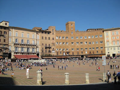
Siena, Italy
Siena, Italy
Siena, a Tuscan jewel of 30,000 souls, bans most traffic from its historic center, shown above. Visitors can park on the outskirts,  walk or take a bus to the cobblestone streets full of shops, restaurants, and museums.

Everyone heads to the central Piazza del Campo for good reason. The huge clamshell-shaped square, where the twice-yearly Palio horse race takes place, is one of the most splendid public spaces in the world. It's perfect for sauntering with a gelato cone or having a drink in one of the cafes lining the square, and, in general, marveling at how Italians can manage that sense of offhand elegance that eludes so many other places.

Siena, Italy
Siena, Italy

12. Green Beach, New York - Big Apple’s Green Beach

Visitors lounge on beach chairs one weekend in the summer of 2009, soon after launch of a pedestrian plaza in New York's Times Square.

The intersection of Broadway, Seventh Avenue, and 42nd Street is best known around the world for its scenes of New Year's Eve revelry. But opportunity for street parties-or simply, safe crossing-expanded after New York cut traffic through the "crossroads of the world."

Begun as an experiment, with cars permitted on cross streets and Seventh Avenue, but Broadway traffic-free for five famous midtown blocks, it was a compromise born out of rough experience for Mayor Michael Bloomberg. The previous year, the New York state legislature had killed his idea to institute congestion pricing-an $8 fee at the tunnels and bridges-to discourage cars from entering Manhattan at prime times.

Green Beach, New York
Relying on fiat instead of fees, the Times Square pedestrian plaza worked. The city even marshaled GPS data showing the limited car-free area improved midtown traffic flow. But most impressively, it cut injuries to motorists 63 percent and to pedestrians, 35 percent, even though foot traffic increased by 11 percent. Before motor vehicle restrictions, not only did pedestrians have to step lively to cross the streets beneath the neon signs, but sidewalks were so crowded that pedestrians spilled dangerously into the traffic lanes.

There's been a less visible impact on safety, too, for the quarter-million visitors to Times Square each day. Levels of nitrogen oxides, fossil fuel combustion emissions implicated in respiratory disease, have fallen dramatically.

Next year, construction is to begin on a permanent Times Square streetscape called Cool Water, Hot Island, a design based on NASA infrared satellite data, and aimed at reducing the urban heat-island effect.

And there's more car-free and reduced traffic landscape planned in New York: 26 pedestrian plazas are being designed or built. Putting a focus on movement of people rather than cars is a key to Bloomberg's wide-ranging plan to cut the city's carbon emissions 30 percent by 2030.
(National Geographic)
Read more

(Canada) – Top things to do in Bay of Fundy

Located off the northern coast of Maine and extending into Canada between New Brunswick and Nova Scotia, the natural phenomenon known as the Bay of Fundy is a 270 km (170 mile) long ocean bay that’s home to the world’s highest tides (54 feet/16m). The Bay of Fundy has a diverse ecosystem and a marine biodiversity comparable to the Amazon Rainforest. Its waters are populated with up to 12 species of whales, an abundance of dolphins, porpoises, fish, seals, seabirds and more.

(Canada) – Top things to do in Bay of Fundy
 
Every day, twice a day 110 billion tonnes of seawater rush into the Bay creating phenomena that can only be experienced to be appreciated. Tides are crucial to this ecosystem and are highly respected by everyone who has seen their effect.  The tide waits for no-one, and life along the Bay is dictated by the ebb and flow of water. 

Below are top things to do around the Bay of Fundy:
1. Whale Watch in the Bay of Fundy
Look for the endangered North Atlantic Right Whale and 6 other species that frequent the Bay of Fundy. Many different whales can be found in the Bay of Fundy in the summer, as it is an abundant feeding ground. Minke whales are plentiful.  You can also find humpbacks, fin whales, and the occasional blue whale.  There are also seals and many types of sea birds in the Bay.

(Canada) - Whale Watch in the Bay of Fundy
2. Walk on the ocean floor

(Canada) - Bay of Fundy - Walk on the ocean floor
 
Walk on the ocean floor and explore the tidal pools where the highest tides in the world have been recorded. Although many places claim to have the highest tides in the world, tides at Burntcoat Head are actually the highest, averaging 55.8', with the highest being set during the 1869 Saxby Gale at 70.9'

(Canada) - Bay of Fundy - Walk on the ocean floor
Visit Hopewell Rocks, located on the New Brunswick side of the Bay of Fundy. At low tide, explore quiet coves with flowerpot-shaped rock formations bearing such curious names as 'Mother-in-Law', 'ET' and 'Lover's Arch'.

(Canada) - Bay of Fundy - Walk on the ocean floor
3. Cape d’Or
With rugged red-colored vertical cliffs on either side and sparkling water stretching out as far as the eye can see Cape d'Or bears testimony to the awesome power of nature.  It has the distinction of being the only place in the world where three tides converge, meeting simultaneously to create violent riptides-a phenomenon known as the Dory Rips. The lookout platform affords views of Cape Split and Ile Haute Island.

(Canada) - Bay of Fundy - Cape D'Or Lighthouse
4. Tidal Bore Rafting
At first, the Shubenacadie River seems like a very lazy river. Situated amid 200-foot-high gypsum cliffs, it starts out as a relaxing paddle past mudflats and sandbars until you reach the mouth of the river, where the tides from the Bay of Fundy come rushing in. Suddenly, you're white-water rafting on the world's highest tides, which travel inland at roughly 50 km an hour and stir up sixteen-foot waves.

(Canada) - Bay of Fundy - Tidal Bore Rafting
5. Hall’s Harbour
Hall's Harbour is a fishing port that works to the ever changing rhythm of the 40 foot Fundy tides. Snugly settled in its picturesque cove, and guarded on each side by tall basalt cliffs, the harbour's inner basin fills twice a day to the top of the towering wharves. Six hours later the water recedes far out into the Bay of Fundy leaving the colourful fleet of vessels dry on the harbour floor.  Beach comb for treasures and watch the landscape change as the tide comes and goes.

(Canada) - Bay of Fundy - Hall’s Harbour
(Wiki and  Bay of Fundy Fun Tours)
Read more

(United States) – Discover Grand Canyon

The Grand Canyon is located entirely in Northern Arizona and is one of the great tourist attractions in the United States. The massive canyon encompasses several distinct areas, most famous of which is Grand Canyon National Park, a United States National Park. The national park is itself divided into two main areas: the remote North Rim and the more accessible (and therefore more crowded) South Rim. In addition, the southwestern end of the canyon is located within the borders of two Indian reservations: the Havasupai Indian Reservation and the Hualapai Indian Reservation (also known as Grand Canyon West). All of the sections of the canyon offer amenities for visitors, but the national park, and in particular the South Rim, is by far the most popular destination and the best equipped to handle the millions of yearly visitors.

(United States) – Discover Grand Canyon
 
How to get there
A family trip to Grand Canyon means time in the car. The train trip from Williams to the South Rim provides a diversion for young kids and is a great option for day visitors and families intent on exploring the Grand Canyon on foot. The only way to get to the Toroweap and the North and West Rims is the automobile. Las Vegas, Phoenix, and Flagstaff are convenient departure points for the West and South Rims. The North Rim is best accessed from points north, Las Vegas, Nevada and Page, Arizona, and can easily be combined with a trip to Bryce Canyon and Zion National Parks as well as Glen Canyon National Recreation Area and Lake Powell. Toroweap is a long way from just about everywhere.

(United States) – Discover Grand Canyon

Getting Around
A free shuttle bus operates four South Rim routes. The North Rim hiker shuttle makes the run from the Grand Canyon Lodge to the North Kaibab trailhead twice each morning (early!). A nominal fee is charged. Trans Canyon Shuttle provides a daily rim-to-rim shuttle service, roughly 4.5 hours, for a fee from mid-May to mid-October. At Toroweap, hiking is the only way to get around. Air tours - helicopter and small plane - depart from the Grand Canyon National Airport in Tusayan, 6 miles south of the entrance to the South Rim. Mule rides are offered on both the North and South Rims. The minimum age varies on North Rim trips. Day and overnight South Rim mule rides have a maximum weight (200 lbs or 91 kg fully dressed) and minimum height (4 feet 7 inches or 140 cm) requirement as well as variety of the other restrictions (fluent in English, good physical condition, no fear of heights or large animals, and pregnant women are not allowed).

(United States) – Discover Grand Canyon
 
When to Travel
Aside from the North Rim, which is best visited in summer, the best time of year to visit the Grand Canyon depends on your interests. Hiking in the canyon is best in spring (March/April) and fall (October/November) whereas summer (June-September) is the best time to hike on the rim. In summer, the daytime temperature along the Colorado River can reach 120º F (50° Celsius)! Expect snow on the South Rim in winter and on the North Rim throughout most of the year. Be prepared for sudden changes in the weather at anytime.

(United States) – Discover Grand Canyon
 
Health & Safety
All points on the North Rim sit at least 8000 feet (2438 m) above sea level. Give your body a chance to acclimate to the elevation before you set out on a serious hike. Visitors with respiratory or heart problems may experience difficulties. Keep a close eye on the kids at all times, even in areas with guardrails.

(United States) – Discover Grand Canyon
 
Hours & Seasons
The South Rim, Toroweap and Grand Canyon West are open year-round. North Rim facilities and visitor services are open from mid-May to mid-October only. Weather permitting; the North Rim is open for day use only from mid-October to mid-May. Opening hours for of the West Rim Entrance and Skywalk are seasonal.

(United States) – Discover Grand Canyon
 
Admission & Fees
Entrance to the North and South Rim areas of the park is charged per vehicle unless you are traveling on foot, bike or motorcycle in which case the fee is per person. Commercial vehicles are charged on capacity. Entrance to Toroweap is free of charge. The West Rim is priced like an attraction and the cost of the entrance fee is based on the activity package you choose. Of note, admission to the Skywalk is not included in all packages and in some cases cannot be added even with an additional fee.

Things to keep in mind
The magnitude of this gaping crevice is difficult for many children to comprehend.

(Wiki and Kids Can Travel)
Read more