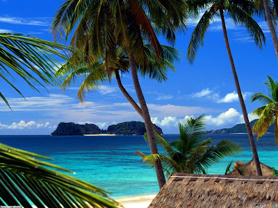
Palawan is an island province of the Philippines. The
provincial capital is Puerto Princesa and it is the largest province in terms
of land area. It is considered as the last frontier of the Philippines.
+%E2%80%93Travel+to+Palawan.jpg "(Philippines) –Travel to Palawan") |
| (Philippines) –Travel to Palawan |
Climate
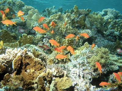
The weather in Palawan is at its best from late February to
about mid May. This is when the oceans are calmest and visibility for
snorkeling and diving is best. Tubbataha dive trips only run during this
period. Very few typhoons cross Palawan due to it lower latitude. The monsoons
bring most of the rain to Palawan and they can develop very quickly, unleashing
torrential downpours. The south west monsoon, "habagat", is from late
May to October. The north east monsoon, "amihan", is from November to
late February. The weather is always hot and humid. Wear the lightest possible
cotton clothes to beat the heat. I recommend shorts, sleeveless shirt and
sandals – no shoes and socks. Remember to always bring your hat, umbrella, insect
repellant, sun-block and sunglasses.
 –Travel to Palawan") |
| (Philippines) –Travel to Palawan |
Central and Northern
Palawan
Puerto Princesa
City - Puerto Princesa City has
a population of about 200,000 and is the Capital of Palawan. Puerto Princesa
City and the Underground River are the most popular Palawan destinations for
Filipinos. This is partly because of the large number of discount flights
coming into the city every day, plus the relatively cheap accommodation
available for large family groups with tight budgets. The typical Puerto
Princesa two-night-three-day dash includes a one day snorkeling tour of Honda
Bay, usually with pickup straight from the airport (need an early flight for
this), a day trip to the Underground River on day 2 and a Puerto Princesa city
tour on day 3, ending just before the late afternoon departure back to Manila.
+%E2%80%93Travel+to+Palawan+2.jpg "(Philippines) –Travel to Palawan") |
| (Philippines) –Travel to Palawan |
There are 9+ daily flights into and out of Puerto Princesa.
The route is served by all of the major airlines with Cebu Pacific having the
most flights. Although the majority of flights are to Manila, there are some to
Cebu, Coron (Busuanga) and Boracay (Caticlan).
The Underground
River at Sabang - The road from Puerto Princesa City to the Underground
River in Sabang is almost completely concreted now and it takes less than two
hours to travel the 80 km. The bus or jeepney will take up to three hours
because it will continually stop to pick up passengers and cargo. Sabang is the
village from where the boats ferry the tourists to the underground river, about
15 minutes away. If you can fit it into your itinerary, consider spending at
least a night in Sabang. There is plenty of accommodation there to choose from.
The beach is nice for swimming but there is a strong undertow sometimes. Also
try to fit in the 1 hour mangrove tour.
 –Travel to Palawan") |
| (Philippines) –Travel to Palawan |
Port Barton
(in the Municipality of San Vicente) - Not as popular as El Nido or the
Underground River, but one of my favorite places in the Philippines. The main
activity there is island hopping, beach lazing and snorkeling. The islands in
the vicinity of Port Barton are being newly developed into high end tourist
resorts, but the impact of them has yet to affect the town of Port Barton. The
road to Port Barton is now passable all year round with the very worst it
having been cemented. During the typhoon season it is still recommended that
your van or car be a 4 wheel drive. Port Barton is only a few hours from Sabang
by boat and this is the preferred method of traveling between the two towns
during the peak tourist season between December and May. Getting from Sabang to
Port Barton is more complicated by road as there is no direct road linking
them.
+%E2%80%93Travel+to+Palawan+5.jpg "(Philippines) –Travel to Palawan") |
| (Philippines) –Travel to Palawan |
Also consider a night or two at Coconut Garden Island Resort
on Cacnipa Island, just a short boat ride from Port Barton town.
 –Travel to Palawan") |
| (Philippines) –Travel to Palawan |
Taytay -
You will pass through Taytay on your way to El Nido when traveling by road.
Taytay was once the capital of Palawan and is most famous for its 17th century
Spanish garrison, Fort Isabel. Taytay is rarely on anyone's itinerary because
the place is not well promoted. I like Taytay and go there often.. Tourism
infrastructure is not as well oiled as in other major Palawan destinations.
Don't let that put you off. There is plenty here to beguile the intrepid
backpacker - and me also. Island hopping and snorkeling are the main activities
around Taytay: bird watching at Lake
Manguao (also called Lake Danao), the largest lake on Palawan, dolphin watching
at Malampaya Sound and swimming in the refreshing Canique Water Fall. The best
thing about Taytay is that there are very few tourists here, especially since
the nearby Club Noah ceased operations recently.
 –Travel to Palawan") |
| (Philippines) –Travel to Palawan |
El Nido -
El Nido is located near the northern tip of Palawan and is a very popular
island hopping destination and famous for its breathtaking seascapes. The high
cost of flying into El Nido or the long trip from Puerto Princesa keeps many
Filipinos away. ITI, a private charter airline, has 3 flights a day into the
privately owned airstrip at El Nido but the first preferences for seats go to
patrons of the high cost island resorts of Lagen and Miniloc. During the peak
season, SEAIR also has several flights a week into El Nido, but I am told that
they have been known to cancel flights at the last moment if there are not
enough passengers. Daily buses and vans go from Puerto Princesa City to El Nido
and the trip can take between 7 and 9 hours, depending on weather conditions.
By far the best way to get to El Nido is by boat from Sabang or Port Barton.
There are daily schedules from December to May. Regular boats to El Nido also
leave from Coron.
 –Travel to Palawan") |
| (Philippines) –Travel to Palawan |
There is a common misconception, especially amongst
Filipinos, that El Nido is a very expensive destination. What is not realized
is that the island resorts can be very expensive, but accommodation in El Nido
town is no more expensive than that of Puerto Princesa City, although it may be
difficult to get cheap accommodation for a large family group.
Calamian group of
islands
This group of islands is part of the Province of Palawan and
is located above the main Island of Palawan. The larger islands are Busuanga,
Culion, and Coron islands. There are also some 95 lesser coral isles and
islets.
 –Travel to Palawan") |
| (Philippines) –Travel to Palawan |
Coron -
The town of Coron (not to be confused with the island of Coron) is on the
island of Busuanga and is the principal city - population about 40,000. It is
about 300km SW of Manila. There are no sandy beaches in Coron town so you would
need to stay on one of the islands to get the “beach” experience. Until
recently, Coron was mainly a destination for sea wreck scuba divers who dive on
the many sunken World War 2 Japanese wrecks. Because there are now four low cost fights
into Coron each day, it has also become a popular destination for Filipinos,
expats and Asian tourists who want to do some island hopping, snorkeling or
kayaking but have only a few days to spare.
 –Travel to Palawan") |
| (Philippines) –Travel to Palawan |
Southern Palawan
Apart from possibly a day trip to Estrella Falls, I would
not recommend Southern Palawan unless you have lots of time on your hands and
are prepared to travel a long way over some bad roads. I have toured Southern
Palawan twice in my 4 wheel drive Suzuki. The first time was to Quezon and
Brooke’s Point via the east coast road. That was in June 2009. On the second trip, which was on the Easter
weekend in April 2010,I traveled via the west coast road, passing through Rizal
and returning via the east coast road via Bataraza. Infrastructure for tourism
in South Palawan is poor and it’s difficult to get information about places to
go, road conditions, etc. It would probably be much more difficult without you
own transport. South Palawan is probably for the more adventurous tourists, but
the west coast circuit is also popular with 4x4 drivers and trail bike riders.
The traveling distances for both of my trips was about 550km.
Buses, jeeps and vans leave regularly from the San Jose
terminal in Puerto Princesa going to Quezon and Brooke’s point. There are
connecting jeepney services that can take you anywhere in Palawan.
+%E2%80%93Travel+to+Palawan+13.jpg "(Philippines) –Travel to Palawan") |
| (Philippines) –Travel to Palawan |
Estrella Falls,
Narra - The Estrella Falls is a popular destination for locals and
Filipino family groups visiting Puerto Princesa and can be an ideal picnic
outing day trip. There are huts for shelter and BBQ facilities for cooking your
own food. The falls are great to swim in and both adults and children should
have a fun day in and around the water. Without local knowledge, it may be
difficult to go the falls by public transport because it is about 8km from the
main road. Best way to do this trip would be to hire a van and driver and do it
as a day trip. The van can accommodate up to 12 people and the price is P3,900
(fixed price) which includes all costs. Take all of the food and drinks you
need. Perhaps purchase it from one of the Puerto Princesa markets on the way.
Grill your food at the falls and don't forget to buy charcoal. Traveling time
to the falls from Puerto Princesa City is about 2.5 hours for a distance of
95kms. Stop at the Aborlan market on the way for a snack or second breakfast.
 –Travel to Palawan") |
| (Philippines) –Travel to Palawan |
Transport around
Palawan
There are no flights around Palawan except from Puerto
Princesa to Coron. The main methods of transport are jeepney, bus, van, hire
van (with driver), rental motorbike or boat.
 –Travel to Palawan") |
| (Philippines) –Travel to Palawan |
Jeepneys, Buses
and Vans - Jeepneys are the cheapest way to travel, and for the
adventurous types, you can sit on the roof if you don't want to be squashed in
like a sardine.. The buses and vans are also usually packed to capacity but the
vans have the advantage of being air-conditioned and are faster as they do not
stop to pickup/drop-off people and cargo. Vans are slightly more expensive than
buses or jeeps. None of the buses are air-conditioned so you can get quite
dusty during the dry months.
 –Travel to Palawan") |
| (Philippines) –Travel to Palawan |
Hire Car -
The only company I know of in Palawan that rents cars without a driver is Pitstop
Bike and Car Rental. They are based in El Nido but you can also pick up from
Puerto Princesa. All their vehicles are 4-wheel-drive.
Hire car or van
with driver - Probably the best ways to see Palawan is to rent a van or
4-wheel-drive with driver. You can rent a vehicle just to pick you up from the
airport and take you to your destination, or you can rent it for your whole
Palawan tour, including all overnights. Hiring a vehicle for your whole tour
opens up a range of options which would be difficult to do with public
transport. It is not expensive - you will pay about P20 per km plus P1500 a
day. Therefore, a 6 day tour of Palawan may cost P20,000. Divide that by 4 to
10 people and it could be a very affordable way to travel. If you want to go
off the beaten track a little, it is better that your van is a 4-wheel-drive.
Note that if you want to hire a vehicle for a one way trip only, you will still
need to pay for the return journey as there is very little chance of the driver
getting passengers for it.
 –Travel to Palawan") |
| (Philippines) –Travel to Palawan |
Motorbike Hire
- There are lots of motorbike rental places in Puerto Princesa City, El Nido
and Coron. Prices vary from about P600 to P1000 a day, depending on engine size
and quality. Discounts are usually available for long term rental. Be sure to
get a mechanically sound motorbike if you intend to go on a long journey,
especially if you have a pillion passenger.
The Backpacker Route
– a Two Week Itinerary for Mid November to May End
You can play around with the schedule but this is the
Palawan tour that I recommend. It can also be done in reverse, of course. If
you are going by private hire car or rental motorbike, the itinerary is the
same but the travel from Sabang to Port Barton and to El Nido would be done by
road and not by boat.
1 – Puerto Princesa – 1 night – Fly Manila to Puerto
Princesa (1 hour) – consider two nights if you are not returning via Puerto
Princesa.
2 – Sabang (Underground River) – 2 nights – go by jeepney
from Puerto Princesa early in the morning (3 hours)
3 – Port Barton – 3 to 5 nights and consider a night or two
at nearby Cacnipa Island – go by boat from Sabang to Port Barton (3 hours)
4 – El Nido – 3 to 5 nights – go by boat from Port Barton to
El Nido (4 hours)
5 option A – Taytay – 1 to 3 nights. By Bus from El Nido (2
hours max). By bus to Puerto Princesa (5 hours), stay 1 to 2 nights - End of
Palawan tour – fly to Manila or go onward
5 option B – Coron – 2 to 3 nights - El Nido to Coron by
boat (7 hours) – End of Palawan tour -
Fly to Manila or go onward
+%E2%80%93Travel+to+Palawan+17.jpg "(Philippines) –Travel to Palawan") |
| (Philippines) –Travel to Palawan |
Money, Foreign
Currency Exchange, Credit Cards and ATM's.
ATMs - The
only ATM machines in Palawan that take international cards are in Puerto Princesa.
There are a couple of ATMs in Coron but they only accept Philippine cards. A
wide range of ATM's can be found around the main entrance to NCCC, the largest
supermarket and department store in Puerto Princesa. For international ATM
cards, I always use the ATM from BPI (Bank of the Philippine Islands), the
largest bank in the Philippines and I have never had a problem with them. The
NCCC ATMs are best to use because there are often power outages in Puerto
Princesa and NCCC has a backup generator while most banks do not.
Do not leave it until the last moment to withdraw your funds
because the ATMs are sometimes all offline and you may not be able to continue
on with your journey for lack of cash. The limit of the withdrawal is usually
P10,000 per transaction, with a maximum of two withdrawals per day from the
same bank. If you require lots more than that, you may need to do it over
several days of from different banks. On one of my trips north I decided to get
my money at the last moment from a BPI bank on the main highway out of Puerto
Princesa. On one occasion, the power failed at the very moment I was waiting
for the ATM to return my card and dispense my money. The ATM kept my card and
did not dispense any money. It was early in the morning, so I had to wait for
the bank to open to get my card back. My overseas bank credited the money back
into my account, so there was only the hassle of it all.
 –Travel to Palawan") |
| (Philippines) –Travel to Palawan |
Some foreigners find themselves in a bind when their
international ATM cards will not work in the Philippines. That is usually
because their bank's security has blocked access to cards in developing
countries. You may need to let your bank know in advance that you will be
traveling in the Philippines. I have never had this problem myself.
Foreign Currency
Exchange - the best place to exchange your foreign notes is in a bank
in Manila. BDO gives good rates. Outside of Manila you may have trouble cashing
anything other than US$ and then with bad rates and large fees. Try Western
Union, their rates may be the best you will get.
If you need money sent to you in Palawan, there are several
of Western Union branches. I know there is one in Puerto Princesa and another
in El Nido.
Credit Cards
- Unless you are staying in a hotel or high end resort, don't expect to be able
to pay by credit card anywhere for anything. Also expect to pay all credit card
charges which may be as high as 7%. There will be no problems or extra charges
for paying for flights with credit cards, as long as you do it through the
airline booking office and not through an agent.
Hazards
Sandflies -
Some of the beaches, especially Palawan, have sandflies. I have been bitten on
the Palawan beaches of Sabang, Port Barton and El Nido. Their bites can lead to
tropical ulcers, or worse, unless you treat them correctly. I am talking from
personal experience. Read my section on Sandflies.
+%E2%80%93Travel+to+Palawan+10.jpg "(Philippines) –Travel to Palawan") |
| (Philippines) –Travel to Palawan |
Malaria and
Filariasis (Elephantiasis) - Malaria, and to a lesser degree,
Filariasis, are problems in some parts of Palawan, especially during the rainy
season. The worst areas are in Southern Palawan and generally in the jungles
and the small villages. I have been assured many times by locals that there is
no malaria in El Nido or Puerto Princesa City. I had heard of cases in Sabang
and Port Barton some years ago but have been told that there have been no
recent cases.
Malaria is transmitted by the Anopheles mosquito and it is
considered endemic in Palawan. Recent efforts to control malaria have shown a
progressive decrease in the number of cases diagnosed and treated.
Unfortunately there is the emergence of resistant cases of malaria due to poor
treatment practices of communities. The common practice within the communities
is to self-medicate, resulting in an
incomplete use of antimalarial drugs combinations or the use of inadequate
doses.
Dengue Fever
- This is another mosquito borne disease that is sometimes fatal, especially
for young children. It is widespread throughout Palawan so take the same
precautions as with Malaria. For tourists the risks are very low, but a little
bit of care will greatly improve the statistics of you not catching dengue.
Rabies - Rabies is endemic in Palawan and many other parts
of the Philippines. If you are bitten by a dog or any other animal, make sure
you go to the nearest clinic for advice and possibly a rabies shot. This is
called a rabies post-exposure prophylaxis. It must be done within 10 days of
the bite but immediately after would be better. The treatment is very
successful, but left untreated, you would eventually die.
 –Travel to Palawan") |
| (Philippines) –Travel to Palawan |
Visa Extensions in
Puerto Princesa City
Renewing your Philippines tourist visa or any other visa is
easily done in the efficient and friendly Palawan field office of the Bureau of
Immigration. You will normally be in and out within 15 minutes. It is possible
to renew a week or so before the expiry date but they may consider doing it
much earlier if you have a valid reason for it. Most tourists can repeatedly
extend for up to a year after which you must leave the country. Tourists and
businessmen get a 21 day visa on arrival and it is stamped in your passport
when you first pass through immigration. No need to get a visa before going to
the Philippines. You can get a first extension that will allow you to stay for
up to 59 days; each extension after that is for 2 month periods.
The first extension costs P2,030 and after that it varies
between about P3,000 and P4,000. It is not the same amount for each 2 month
extension.
The visa requirements are simple. You need your passport, a
single photo copy of your main passport page and one of the page with your
entry stamp on it. If you have renewed before, also include a photocopy of the
page with your last visa extension if it is not on the same page as the entry
stamp. No photograph required. The single visa form you fill out is straight
forward. The photocopies cannot be done at the immigration office so you must
bring them with you. There is a place somewhere across the road from the office
that does photocopies and there are many more on the main street in the city
center.
 –Travel to Palawan") |
| (Philippines) –Travel to Palawan |
If you have overstayed on your visa there is no problems
renewing but there will be a penalty of (I think) P110 if you are over by a few
days. Better to fix it up at the immigration office rather than at the airport.
Don't panic if you find that you are over the visa limit; it often happens and
there is no "heavy scene" as this is a common mistake. I have met
tourists who obtained their Philippines visa in their home country and
misinterpreted the length of stay. The visa might say that it is "valid
for 3 months" but that only means that you must enter within the three
months and not that you can stay for 3 months.
The immigration office is located on Rizal Avenue, just a
little over 200 meters from the airport exit heading into town and on the other
side of the road. The actual office
entrance is at the back of a building on the second floor. The dress code is as
casual as you like, i.e. shorts, slippers and T-shirt, unlike the requirements
in Manila. Open 5 days a week but not on public holidays. Closed for lunch
between 12 and 1.
(Wiki
Travel, Travel Philippines)
+%E2%80%93+Moorea+%E2%80%93+Island+of+love+3.jpg "(Polynesia) – Moorea – Island of love")
 – Moorea – Island of love")
 – Moorea – Island of love")
 – Moorea – Island of love")
+%E2%80%93+Moorea+%E2%80%93+Island+of+love+5.jpg "(Polynesia) – Moorea – Island of love")
 – Moorea – Island of love")
 – Moorea – Island of love")
 – Moorea – Island of love")
+%E2%80%93+Moorea+%E2%80%93+Island+of+love+10.jpg "(Polynesia) – Moorea – Island of love")
 – Moorea – Island of love")
 – Moorea – Island of love")
 – Moorea – Island of love")
+%E2%80%93+Moorea+%E2%80%93+Island+of+love+13.jpg "(Polynesia) – Moorea – Island of love")
 – Moorea – Island of love")
 – Moorea – Island of love")
+%E2%80%93Travel+to+Palawan.jpg "(Philippines) –Travel to Palawan")
 –Travel to Palawan")
+%E2%80%93Travel+to+Palawan+2.jpg "(Philippines) –Travel to Palawan")
 –Travel to Palawan")
+%E2%80%93Travel+to+Palawan+5.jpg "(Philippines) –Travel to Palawan")
 –Travel to Palawan")
 –Travel to Palawan")
 –Travel to Palawan")
 –Travel to Palawan")
 –Travel to Palawan")
+%E2%80%93Travel+to+Palawan+13.jpg "(Philippines) –Travel to Palawan")
 –Travel to Palawan")
 –Travel to Palawan")
 –Travel to Palawan")
 –Travel to Palawan")
+%E2%80%93Travel+to+Palawan+17.jpg "(Philippines) –Travel to Palawan")
 –Travel to Palawan")
+%E2%80%93Travel+to+Palawan+10.jpg "(Philippines) –Travel to Palawan")
 –Travel to Palawan")
 –Travel to Palawan")
+%E2%80%93+Let%E2%80%99s+travel+to+Rabbit+Island+%C5%8Ckunoshima+in+the+Inland+Sea+1.JPG "(Japan) – Let’s travel to Rabbit Island Ōkunoshima in the Inland Sea")
+%E2%80%93+Let%E2%80%99s+travel+to+Rabbit+Island+%C5%8Ckunoshima+in+the+Inland+Sea+2.jpg "(Japan) – Let’s travel to Rabbit Island Ōkunoshima in the Inland Sea")
+%E2%80%93+Let%E2%80%99s+travel+to+Rabbit+Island+%C5%8Ckunoshima+in+the+Inland+Sea+3.JPG "(Japan) – Let’s travel to Rabbit Island Ōkunoshima in the Inland Sea")
+%E2%80%93+Mustang+Trekking+1.jpg "(Nepal) – Mustang Trekking")
 – Mustang Trekking")
+%E2%80%93+Mustang+Trekking+3.jpg "(Nepal) – Mustang Trekking")
 – Mustang Trekking")
 – Mustang Trekking")
+-+Mustang+Lo+Manthang+Tiji+Festival.JPG "(Nepal) - Mustang Lo Manthang Tiji Festival")
 - Mustang Lo Manthang Tiji Festival")
+%E2%80%93+Mustang+Trekking+-+Lo+Manthang+-+capital+of+the+kingdom+mustang.JPG "(Nepal) – Mustang Trekking - Lo Manthang - capital of the kingdom mustang")
+%E2%80%93+Visit+The+Geirangerfjord+1.jpg "(Norway) – Visit The Geirangerfjord")
 – Visit The Geirangerfjord")
 – Visit The Geirangerfjord")
 – Visit The Geirangerfjord")
+%E2%80%93+Visit+The+Geirangerfjord+5.jpg "(Norway) – Visit The Geirangerfjord")
 – Visit The Geirangerfjord")
+%E2%80%93+Visit+The+Geirangerfjord+8.jpg "(Norway) – Visit The Geirangerfjord")
 – Visit The Geirangerfjord")
+%E2%80%93+Visit+The+Geirangerfjord+9.jpg "(Norway) – Visit The Geirangerfjord")